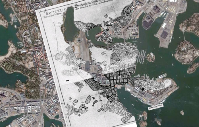
view in google earth: helsinki 1701 (kmz opens a 1,3mb .png file in google earth)
central helsinki in 1701 was a lot different to what it is now, kluuvilahti (gloviken, kluuvi bay) stretched down from töölönlahti towards aleksanterinkatu. the map above is 308years old and doesnt really match up perfectly with the satellite image in google earth – but its enough to show the differences.
the old shoreline of kluuvilahti is remembered in the streetart piece kluuvinlahden fossiilit by tuula närhinen.
more info about the history of kluuvilahti here (in finnish):
kluuvi kuivatus
hel ksv: viikonnimi – kluuvi
thanks to mari for this random image. (its taken from “helsingin neljävuosisataa” by eino e. suolahti)